Javascript is disabled on your browser.
To view this site, you must enable JavaScript or upgrade to a JavaScript-capable browser.
Skip to main content
Need Help?
(877) 622-5779
Go
Waterfowl
Decoys
Duck Decoys
Goose Decoys
Motion Decoys
Decoy Accessories
Calls
Duck Calls
Goose Calls
Lanyards
Call Accessories
Blinds
Layout/Field
Dog Blinds
Boat
Material & Accessories
Waterfowl Gear
Bags & Backpacks
Seats
Game Carriers
Waterfowl Gear Accessories
Clothing
Waterfowl Jackets
Waterfowl Vests
Waterfowl Pants
Waterfowl Shirts
Waterfowl Bibs
Waterfowl Gloves
Waterfowl Headwear
Women's
Youth
Water Dog
Dog Vests
Training Supplies
Kennels
E-Collars
Dog Stands
Collars & Leads
Water Dog Accessories
Waders
Chest
Waist
Hip
Women's
Youth
Accessories/Waterproof/Repair
Shooting
Ammunition
Rifle Ammunition
Handgun Ammunition
Rimfire Ammunition
Shotgun Ammunition
10 Gauge
12 Gauge
16 Gauge
20 Gauge
28 Gauge
410 Gauge
Guns
Shotguns
Rifles
Handguns
Black Powder
Storage
Shotgun Cases
Rifle Cases
Gun Racks
Gun Safe Accessories
Accessories
Shotgun Choke Tubes
Firearm Sights
Gun Holsters
Gun Slings
Gun Cleaning Supplies
Other Gun Accessories
Tactical Gun Parts
Ammunition Storage & Magazines
Hearing & Eye Protection
Shooting Targets & Accessories
Targets
Target Throwers
Shooting Rests
Clay Shooting Accessories
Optics
Binoculars
Scopes
Optics Accessories & Mounts
Rangefinders
Hunting
Archery
Bows
Crossbows
Broadheads
Arrows
Arrow Rests
Arrow Accessories
Archery Targets
Releases
Accessories
Bow Cases
Bow Sights
Quivers
Bow Stabilizers
Bowfishing
In-Store Bows
Decoys
Deer Decoys
Turkey
Predator
Dove
Other Decoys
Blinds & Stands
Ground Blinds
Climbing Stands
Towers & Blinds
Ladder & Tripod Stands
Fixed Position Treestands
Treestand/Blind Accessories
Hunting Gear
Bags & Backpacks
Camping Adventure
Lights And Batteries
Stools/Chairs
Coolers
Cutlery & Knife Accessories
Body Warmers
Traps & Accessories
Insect Repellent
Calls
Deer Calls
Turkey
Predator
Other Calls
Game Cameras
Feeders & Food Plots
Scents & Attractants
Game Processing & Mounting
Footwear
Hunting Boots
Work Boots
Snake Boots
Hiking Boots
Women's/Youth Hunting
Socks
Boot Dryers
Boot Accessories
Clothing
Hunting Jackets
Hunting Vests & Hoodies
Hunting Pants
Hunting Bibs
Hunting Shirts
Hunting Gloves
Turkey Apparel & Accessories
Rain Gear
Base Layers
Womens
Youth
Hunting Hats
Scent Control
Casual
Mens
Shirts
Pants
Jackets
Vests
Headwear
Shorts
Bags & Luggage
Grooming
Accessories
Womens
Sweaters & Sweatshirts
Shirts
Jackets & Vests
Pants
Shorts & Skirts
Sleepwear
Women's Headwear
Handbags & Totes
Accessories
Youth
Shirts
T-Shirts
Accessories
Pants And Shorts
Infant-Toddler
Jackets
T-Shirts
T-Shirts
Footwear
Men's Casual
Women's Casual
Youth Casual
Home and Gift
Food & Kitchen
Toys
Decor
Gifts
Jewelry
Sunglasses
Marine
Fishing Gear
Fishing Rods & Poles
Fishing Reels
Fishing Lures
Fishing Accessories
Fishing Apparel
Boats
Boat Oil & Lube
ATV & Automotive
Life Vests
Trailer Accessories
Marine Parts & Accessories
Boat Seats
Propellers
Boat Motors
Bargain Blind
HUNTING GEAR
HUNTING CLOTHING
HUNTING FOOTWEAR
ARCHERY-TURKEY-DEER
AMMUNITION
GUNS & ACCESSORIES
MARINE-FISHING
T-SHIRTS
MENS
WOMENS
YOUTH
CASUAL FOOTWEAR
GIFTS & ACCESSORIES
Brands
Top Brands
ALPS Outdoorz
Ameristep
Apex Ammunition
Avery Outdoors
Avian-X
Banded
Benchmade Knife
Benelli
Beretta
Browning
Browning Ammunition
Browning Firearms
Camo Systems
Columbia
Costa Del Mar
Covert Scouting Cameras
Dakota Decoys
Danner
Dave Smith Decoys
Drake Waterfowl Systems
Echo Calls
Elite Duck Calls
Franchi
G&H Decoys
GatorTail
Greenhead Gear
Havoc Calls
Haydels Game Calls
Higdon Decoys
JJ Lares Professional Calls
Jargon Game Calls
Jebs Precision Choke Tubes
Kuhl
Lacrosse Footwear
Lifetime Decoys By HEYDAY
Lucky Duck Premium Decoys
MOmarsh
Mack's Prairie Wings
McAlister Company
Migra Ammunition
Millennium Marine
Millennium Treestands
Mojo Outdoors
Morrell Targets
Moultrie
Mountain Khakis
Mud River Dog Products
Muddy Outdoors
Natural Gear
Nordic Components
Ol' Tom Gobbler
Patagonia
Patternmaster
Preston Pittman
Primos
Rage Expandable Broadheads
Ravin Crossbows
Reaper Boats
Rich N Tone
Rig Em Right
Singleton Game Calls
Sitka Gear
SportDOG
Stoeger Industries
Summit Treestands
Sure-Shot Game Calls
Thacha
Thor Boats
Tom Teasers
Trophy Ridge
Trophyline Tree Saddles
Uhlenhopp Game Calls
War Eagle Boats
White Rock Decoys
Winchester Ammunition
Winchester Repeating Arms
Wonderduck Decoys
Yamaha Motor Corp
Yeti
Zink Calls
See All Brands
Login
Register
0
Your cart is empty
Free Premium Ground Shipping Over $99.00*
Home
>
Hunting
>
Hunting Gear
Back
Skip to search results
Hunting
Bags & Backpacks
Camping Adventure
Lights And Batteries
Stools/Chairs
Coolers
Cutlery & Knife Accessories
Body Warmers
Traps & Accessories
Insect Repellent
See More
See Less
Hunting Gear
Bags & Backpacks
Body Warmers
Camping Adventure
Coolers
Cutlery & Knife Accessories
Insect Repellent
Lights And Batteries
Stools/Chairs
Traps & Accessories
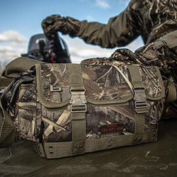 Bags & Backpacks
  Body Warmers
  Camping Adventure
 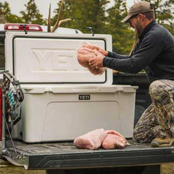 Coolers
 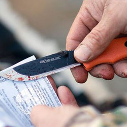 Cutlery & Knife Accessories
 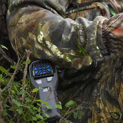 Insect Repellent
  Lights And Batteries
  Stools/Chairs
  Traps & Accessories